February 20, 2024
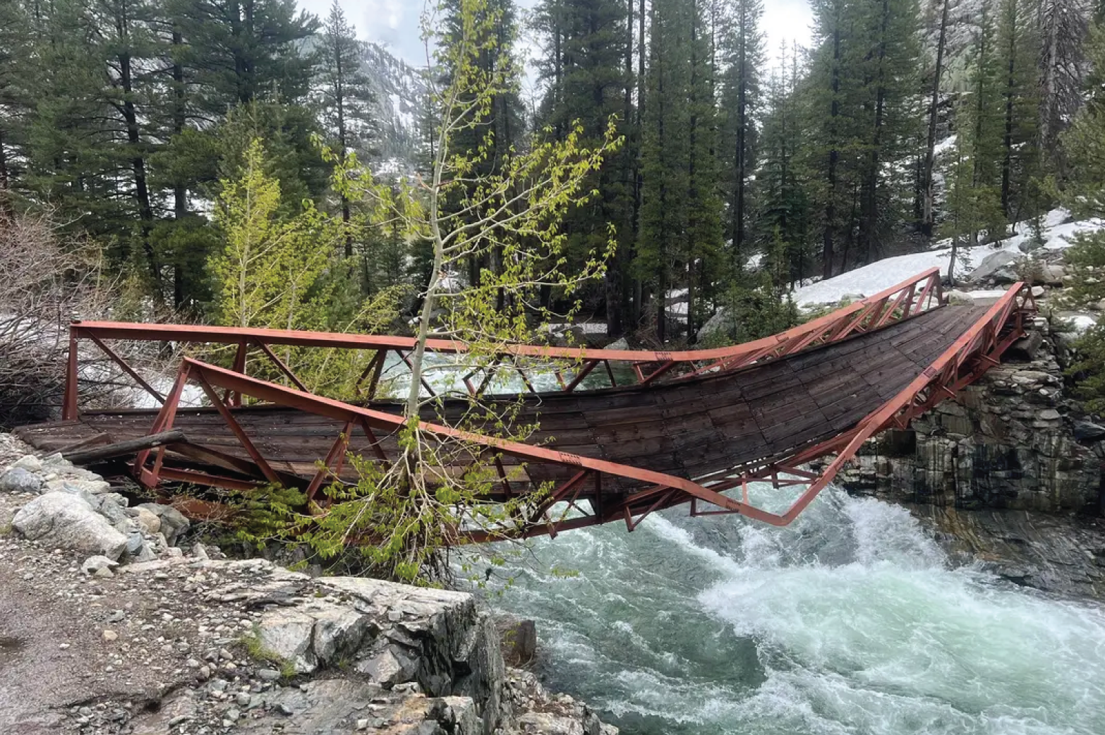

Last winter, a 100′ steel bridge that crosses the South Fork of the San Joaquin River in Kings Canyon National Park collapsed under the weight of the record-breaking snowpack. As of August 2023, the bridge has been fully demolished, and construction is set to start in summer 2024. There is currently no estimated completion date.
This section of the San Joaquin is deep, fast-moving, and is usually not fordable. 2023 JMT hikers used a variety of detours and workarounds to bypass this section. Until the new bridge is completed, 2024 JMT hikers will need to plan on using one of the options below.
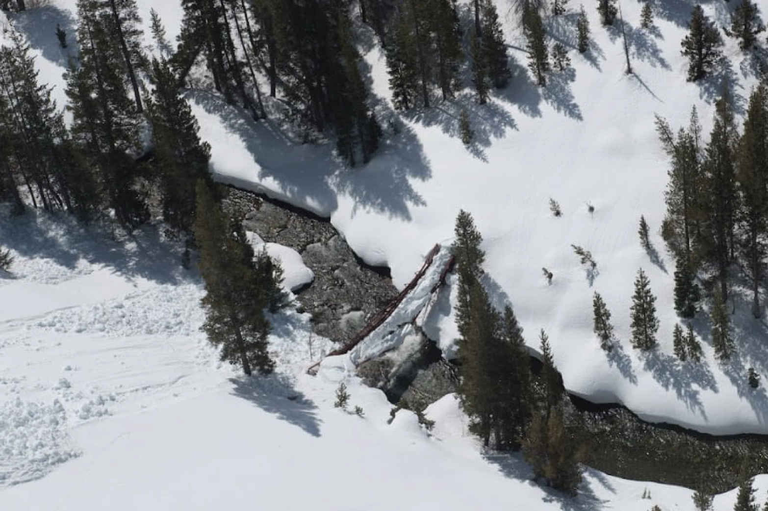
The bridge over the South Fork of the San Joaquin under the heavy snowpack of winter '22/'23.
Bishop Pass & Piute Pass
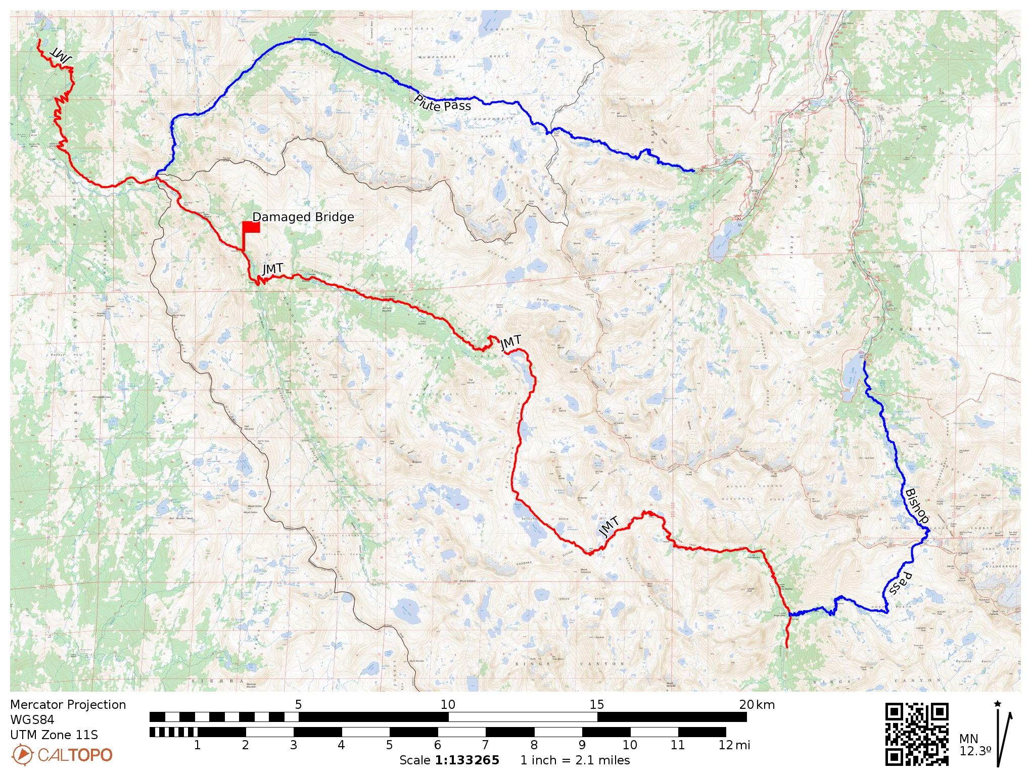
This is the recommended bypass option, and the hiking portion uses well-maintained trails.
If heading northbound, you’ll leave the JMT in Le Conte Canyon and hike into Dusy Basin, over Bishop Pass, and down to the South Lake trailhead. You will need to organize a ride, hitchhike, or walk the road to the North Lake trailhead. From there, you will hike over Piute Pass into Humphrey’s Basin, continue down into Piute Canyon, and rejoin the JMT approximately 3 miles south of Muir Trail Ranch.
This detour bypasses 26.7 miles of the JMT, including all of Evolution Valley and Muir Pass. The bypass is 29.2 trail miles (6,190′ gain, 6,390′ loss) and 12 road miles (1,300′ gain, 1,900′ loss).
Hell For Sure Pass
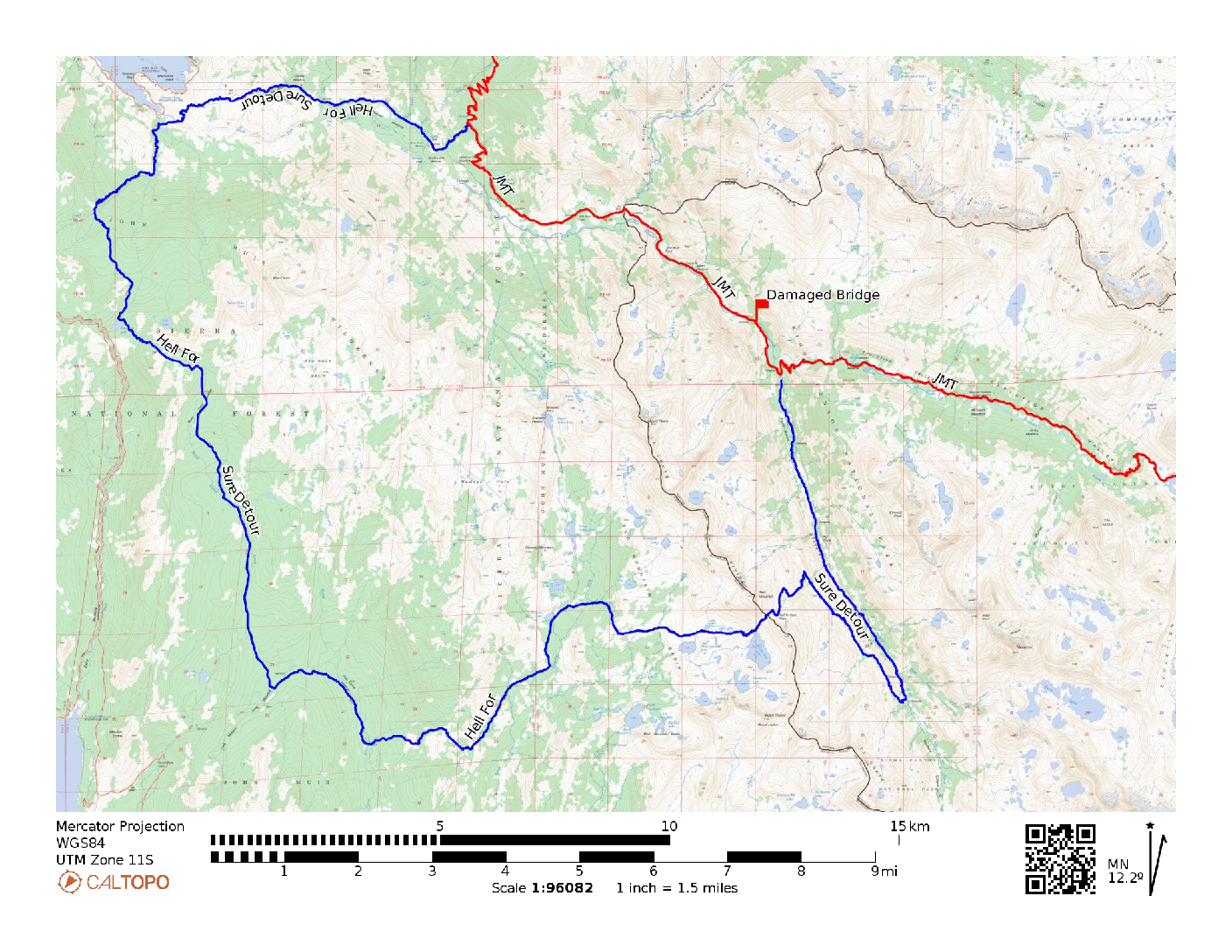
Another detour option that is fully on trail is Hell For Sure Pass. The benefit of this option is that hikers will get to see the Evolution Valley and Muir Pass while only missing about 7 miles of the JMT; however, it adds nearly 35 miles with around 7,800′ of gain and loss.
Hiking northbound, you will leave the JMT after passing through the Evolution Valley and head south into Goddard Canyon. Continue west over Hell For Sure Pass and follow the trail as it brings you north to Florence Lake and then back east to rejoin the JMT by Muir Trail Ranch.
Note: It’s been brought to our attention that although this detour is shown as fully on trail on USGS and USFS maps of the region, the trail can be difficult to follow and is not well maintained in every location. Before taking this detour, be sure to have a reliable GPS track of the route and/or hard-copy maps and the ability to route find.
Off Trail & Class 2/3 Options
There are more options to avoid the downed bridge such as crossing the Glacier Divide at Alpine Col or traveling cross country between Evolution Creek and beyond the bridge outage, but these require significant skill in class 2 and class 3 terrain. We do not recommend these unless you have extensive experience navigating off-trail in the High Sierra.
Other Resources
There are multiple JMT hiker Facebook groups and message boards. Hikers often post trip reports quickly after returning home, which is helpful for finding out current trail conditions and which detours are most popular. Visit the Resources section on our Hiking the JMT page for links to these groups.